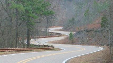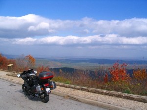
Know where the Pig Trail is and why you care?
This area of the Ozarks has many great roads. I am sure many great routes will be posted here and be sure to enjoy them if you wish. I also encourage you to take this chance to relax, explore where you want, see something new and plan your days so you get exactly what you want from your vacation. We are here to help you with that.
NEWS: We are starting to put route files up now as of 5/5. Go take a look at what we have so far. Additions and corrections could happen so check back here before you ride.
Sample Rally Ride Routes
The fine print… The sample routes and GPS files provided on this web site have been created or compiled by different people. The Concours Owners Group (COG) cannot assume responsibility for your personal safety when using these sample routes. If you choose to use these sample routes, you do so voluntarily, based on your own assessment of your abilities, current road conditions and facilities, and therefore assume all risks. These routes are made available as samples of possible routes in the rally area. They are provided without any guarantee of accuracy, road quality, or safety. As with any route provided, we recommend following the route on a map first. This way you will have a better idea of where you are going and have more fun doing it.
I understand that the Concours Owners Group (COG) cannot assume responsibility for my personal safety when using these sample routes. If I choose to use these sample routes I do so voluntarily, based on my own assessment of my abilities, the routes conditions and facilities, and therefore assume all risks. I release and hold harmless COG, its officers, agents and members from any and all injury and/or loss to my person or property that may result from using these routes or participation in this event. I understand that the routes available for me to download are only samples of possible routes in the rally area. They are provided without any guarantee of accuracy, road quality, or safety. As with any route provided, we recommend following the route on a map first. This way you will have a better idea of where you are going and have more fun doing it.
By clicking on any of the links below I acknowledge that I have read and agree to this statement.
| Name | Description | Miles | Map |
|---|---|---|---|
| Suspension Bridge | This is a very short route good for closing the day if you get back early from a longer ride. It is a nice ride and the old suspension bridge is fun to cross. | 29.5 | Map |
| Push Mtn | Push mountain is known for it’s good pavement and many sweepers. | 259 | Map |
| Pea Ridge | This is another short ride over some good roads that take you by a National Military Park that goes back to the Civil War and documents that battle. Takes you over Beaver Lake. | 72.9 | Map |
| Mt Judea | Medium length ride that includes 2 roads that should be a must on your riding list. Ar 374 and Ar 123 make for great riding. | 176 | Map |
| Devil's Den | This ride also goes down the length of Ar 23 and past RiverTowne Bbq for lunch. It then starts back up and takes you through Devil’s Den State Park which is quite pretty. | 230 | Map |
| Branson Loop | The Branson loop goes north from Eureka Springs into Missouri. It crosses the lakes a couple of times and comes very near to Branson, Mo. | 106 | Map |
| AR 215-221 | This ride takes you down most of the way down Ar 23 then onto Ar 215 and through Ar 103 which are the other must do roads. There is a tiny town that has a General Store that has been there almost forever and serves breakfast and lunch. | 235 | Map |
| Talimena Loop | This is our longest ride taking you the length of Ar 23, past RiverTowne Bbq down to Mena Ar and the Branding Iron Bq and Steak. | 414 | Map |
| Peels Ferry | This ride takes you to the only ferry still operating in the state of Arkansas. Naturally you have to ride some twistys before and after. | 171 | Map |
| Fred to Mt Judea | This route was made by Fred Harmon our famous C-14 tech editor. Fred comes in from a different direction and does a little more of Ar 123 than the last route and has lunch at the Ozarke Café after you ride Ar 123. | 247 | Map |
| Mt Nebo | This ride takes you down the length of Ar 23 and past RiverTowne Bbq which is a very good place to eat lunch. Then takes you over the top of Mt Magazine and to the top of Mt Nebo. | 300 | Map |
| Rally Routes -1 | PDFs ONLY | ||
| Rally Routes - 2 | PDFs ONLY | ||
| All Routes | Garmin .GDB File | GDB | |
| Big Ben | Collection of rides by Ben Otumu | Map |
NOTE: There is also route information on the following Forum Post. However, these are not the best way to get paper routes for your tank bag. The PDF files in the library links above are made for that. Some will be available at the rally but please try to print your own before you get there to save us money for better prizes.
_____________________________________________________
Here is great resources for riding in the area.
http://www.cruisetheozarks.com/
http://www.harrisonarkansas.org/motorcycling/overview-a-routes.html
Here are some tips for group riding from the MSF.
Explore the site for more great riding tips also.
http://msf-usa.org/downloads/Group_Ride.pdf
Links for Dual Sport and Standard Bike Rental.
http://www.pigtrailhd.com/rent.asp
http://www.arkansasadventurerider.com/
Fly into Dallas and ride up on a C14
http://www.sportryderrentals.com
Fly into Little Rock and get a Harley. I have not found C14 for rent in Arkansas yet so let me know if you do.
__________________________________________________
Need Pure Gas? Here is a great resource for finding pure gas in any area even the rally location. Even an APP for your Iphone.

